The go-to source for global trade intelligence
With actionable real-time data and intelligence, we enable forward-thinking businesses to plan, grow, and move sustainably into the future
.webp)


Rely on data, not guesswork
Stay ahead of the curve with the game-changing platforms of Kpler, providing you the most robust data exactly when you want them
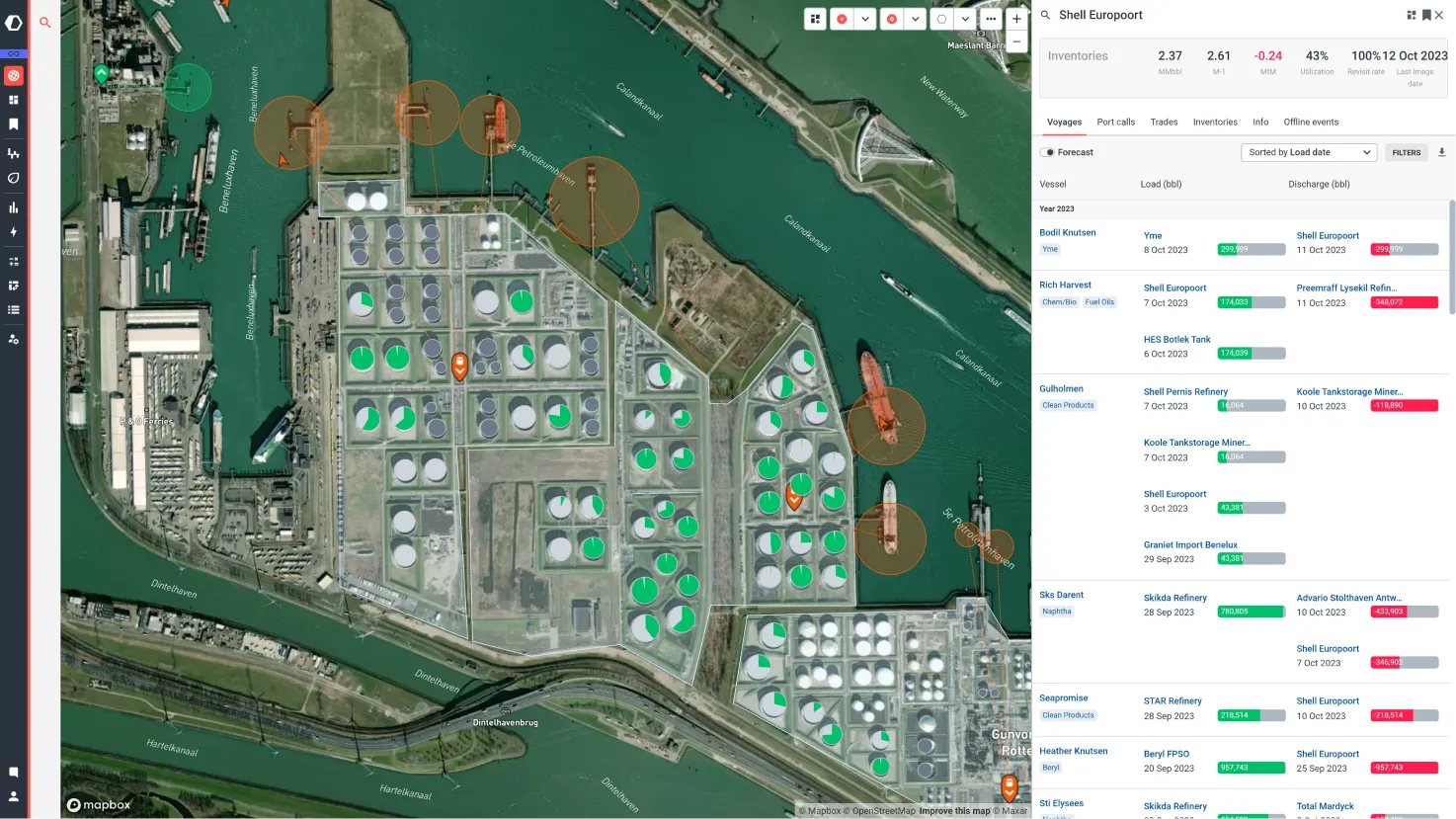
Commodities
Master 40+ commodities, spot trends, control storage, and predict prices. Stay ahead of the markets.
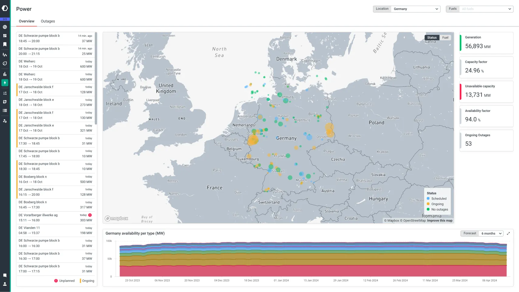
Energy Transition
Evolve with the energy transition using real-time power market insights and renewable fuel data. Don't get left behind.
Maritime
Unlock global freight trends, track containers, and optimise your fleet operations with data and tools from the market's largest AIS network!
%20(1).webp)
A solution for every market
Delivering transparency for players across the ecosystem
Physical markets
Key fundamentals data across crude oil, refined products, chemicals, dry bulk, and more to gain clarity in physical commodity markets.


Power markets
Follow the energy transition as it evolves with crucial real-time data on European power, LNG, coal, and more to keep you ahead in power markets.
Financial markets
Understand the impact of commodity flows across asset classes with data to identify commercial performance and macroeconomic impact.


Shipping & transportation
Leverage the largest AIS network in the world to optimise your planning, maritime logistics, and fleet management.
Who we serve
Kpler enables a wide variety of roles to achieve strategic and operational excellence
For physical traders & analysts
Model supply & demand balances, identify arbitrage and trade ideas, conduct price discovery and forecasting
For financial traders & analysts
Evaluate commodity futures, equities, fixed income, and derivatives with robust and granular real-time fundamentals based on hard sources
For charterers
Monitor freight bottlenecks and effectively forecast delays, evaluate competitive performance and forecast freight supply & demand
For vessel operators & fleet managers
Track vessels, observe vessel emissions, identify fleet performance, optimise routing and logistics
For logistics & supply chain managers
Track container shipments with predictive ETAs, increase collaboration, avoid costly delays and demurrage
Latest insights
Read our blog

Hey, how can we help you today?
Get in touch and see why the most successful traders and shipping experts use Kpler


